Coast snapshot
- Type
- Storm-built boulder ridge
- Region
- Southwest Reykjanes, near Reykjanesviti
- Time
- About 20 to 45 minutes
- Best for
- Coast, geology, and photo pauses
- Access
- Road 425 and rough coastal ground
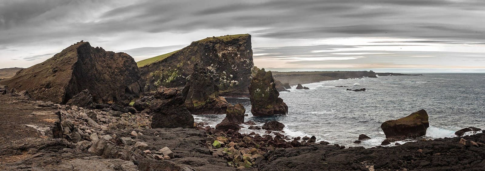
Valahnúkamöl is a storm-built boulder ridge at the southwest tip of Reykjanes, useful for travelers who want a rough coastal stop near Reykjanesviti, Gunnuhver, and the peninsula’s volcanic shoreline.
Coast snapshot
Valahnúkamöl is worth adding when your day is already built around the southwest tip of Reykjanes. It is less convincing if you would drive from Reykjavík only for this one boulder ridge.
The stop works because it is physical and immediate: rounded stones underfoot, Atlantic weather in your face, dark coastal rock, and views that connect naturally with Reykjanesviti and Gunnuhver.
Give it space when you want a raw coast pause between stronger Reykjanes anchors. Drop it first when wind, road timing, or limited daylight would turn the visit into a rushed photo from the car.
Photo guide
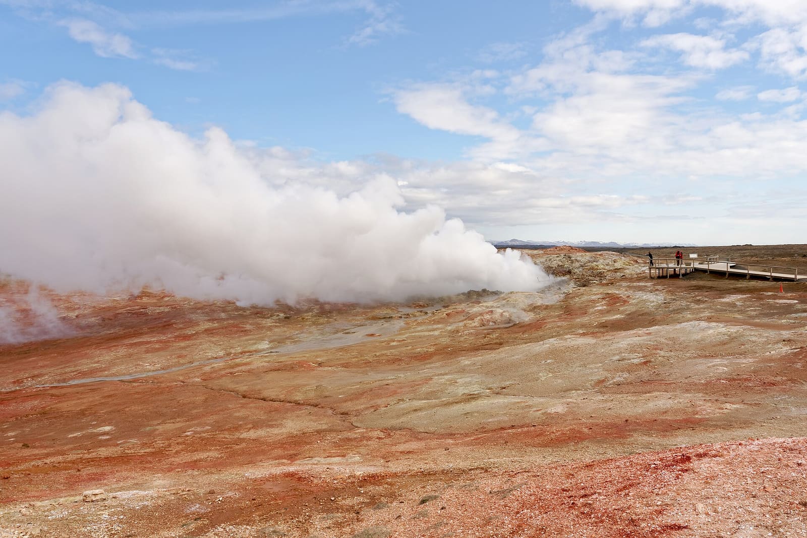
Gunnuhver is one of the nearby anchors that can turn Valahnúkamöl into part of a fuller Reykjanes loop.
The official regional description is simple: a high ridge of well-rounded stones, shaped by powerful storms, high waves, and surf. In person, that means texture matters more than scale.
Visit Reykjanes describes the ridge as roughly 420 meters long, 80 meters wide, and 10 meters high, with stones large enough to make the ground feel uneven rather than beach-like. That is the main reason to come: you are seeing wave force made visible in stone.
Do not plan this like a comfortable beach walk. The surface can be awkward, the coast is exposed, and the best part of the stop is often standing back long enough to understand how the boulder berm, Valahnúkur area, and sea stacks sit together.
Valahnúkamöl belongs in a western Reykjanes cluster. It is strongest when paired with lighthouse, geothermal, beach, and rift stops instead of being treated as a headline destination.
A practical loop might combine Bridge Between Continents, Sandvík, Reykjanesviti, Gunnuhver, and Valahnúkamöl before deciding whether Brimketill still fits. The order matters less than keeping the day flexible.
This is also why the stop can suit arrival or departure days near Keflavík Airport. It gives a strong first or last impression of Reykjanes when you still have enough margin for conditions, daylight, and driving energy.
The attraction is straightforward in calm conditions, but the southwest Reykjanes coast is exposed. Build the day around official checks instead of assuming access, surf, roads, and weather will behave.
Reykjanes Geopark warns visitors about cracks near Valahnúkur and advises staying clear of visible cracks and edges. That caution matters for Valahnúkamöl because travelers often combine the boulder ridge with cliff viewpoints and nearby coastal paths.
Regional place page for location, ridge description, coordinates, and nearby Reykjanes context.
Geosite context and visitor caution for the Valahnúkur and Valahnúksmöl area.
Travel-condition alerts and safety guidance for Iceland visitors.
Official road-condition and closure source before driving Reykjanes roads.
If you have a little extra curiosity, Valahnúkamöl has more than stones. The area also carries small cultural details that make the stop feel less like a bare coordinate.
Visit Reykjanes points travelers toward Geirfuglinn, the Great Auk sculpture below Valahnjúk. Guide to Iceland’s image set also records the Eurovision movie keyboards associated with the area. Neither detail should decide the whole day, but each gives the stop a memorable local edge.
For most travelers, the better secondary angle is still the wider coast: Karlinn offshore, Valahnúkur above the shoreline, Reykjanesviti nearby, and the sense that this edge of Iceland is shaped by both volcanic ground and heavy surf.
If your Reykjanes day is already crowded, choose the stop that answers the clearest question for your trip. Valahnúkamöl is atmospheric, but nearby places often carry stronger first-time value.
Choose Gunnuhver for steam and geothermal force, Reykjanesviti for a clearer lighthouse-and-coast anchor, Bridge Between Continents for simple plate-boundary interpretation, and Brimketill for a compact lava-and-surf viewpoint.
Choose Valahnúkamöl when you specifically want the boulder ridge, the rougher coastal edge, and a short stop that feels less polished than the peninsula’s better-known sights.
By ThorPublished Updated
Map
Use nearby places and useful bases before opening directions.
Interactive planning map for Valahnúkamöl
Interactive map
Place context and external map links remain available without loading it.
Planning context
Open the region or practical guide that resolves the next planning decision.
Next step
Use the next page that helps turn this stop into a practical route decision.