Stuðlagil is a basalt-column canyon cut by the Jökla in East Iceland. Choose the Grund viewpoints for a shorter visit or the Klaustursel east-side hike for a longer walk. Parking choice, river conditions and slippery rock shape the outing.
Short stop snapshot
Type
Basalt-column canyon with viewpoint and hike access
Region
Jökuldalur in East Iceland, inland from Egilsstaðir off Route 923
Route context
Best as a deliberate East Iceland stop on a longer Ring Road route, not as a casual pull-off
Time to allow
Grund: a short viewpoint visit; east side: about 5 km or 10 km return, depending on parking
Effort
Ranges from an easy overlook to a longer walk on gravel, uneven paths, and wet or slippery rock near the canyon
In this guide
Stuðlagil’s basalt columns and the Jökla river
Stuðlagil cuts through columnar basalt in Jökuldalur, inland from Egilsstaðir. The Jökla runs between the rock walls, with water color and level changing through the seasons.
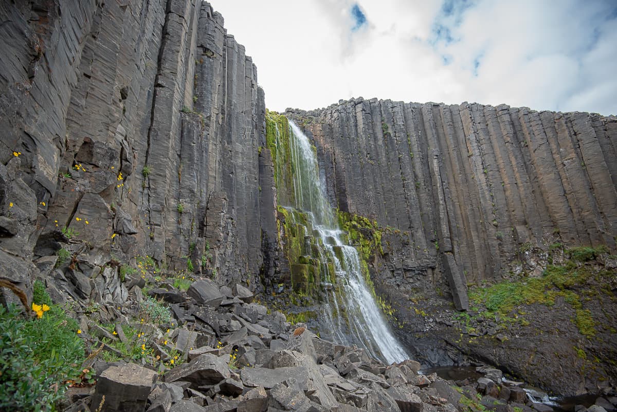
The narrow gorge exposes tightly packed basalt columns, some straight and others curved or broken into smaller forms. Reduced river flow after the Kárahnjúkar hydropower development revealed more of the canyon that visitors see today.
The rock formations remain the main reason to visit when the river is gray or brown. Blue-green water can make a striking contrast, but a photograph cannot tell you what the river or paths will be like on your day.
Add Stuðlagil when the trip already owns an East Iceland day around Egilsstaðir or a slower Ring Road segment. Cut it from a rushed transfer day where the stop becomes a scramble instead of a highlight.
Stuðlagil detour decision
Choice
When it fits
Why it works
Go
You have real East Iceland time and want a named natural stop with route value
The canyon gives the day a strong visual anchor instead of another anonymous pull-off
Go slowly
You want to choose your side carefully and leave room for walking and photos
Stuðlagil rewards margin more than speed
Skip
You are racing between overnight bases and only want effortless roadside sightseeing
The detour loses value when you cannot absorb the drive, side choice, and walking
Check first
Road conditions, wind, footing, or side-specific access could change the plan
Official guidance should decide whether the stop still makes sense that day
Grund viewpoints or the Klaustursel east-side hike
The Grund approach reaches the west-side observation platforms. Klaustursel provides the eastern hiking approach. Decide which visit you want before following a canyon pin.
From Route 1, take Road 923 into Jökuldalur. Follow the signs for Grund for the shorter platform visit, or Klaustursel for the east side. The two approaches have separate arrival points; you cannot switch banks by walking through the river.
Choose the bank and parking approach before setting walking time.
Arrival
Walking commitment
What to check
Grund, west side
Short walk to the observation platforms
Follow the current signed platform routes; lower paths and stairs can change.
Klaustursel, parking by the bridge
About 10 km return to the canyon
Allow for the longer approach, the return walk and photo pauses.
Check the rough approach road and vehicle suitability before continuing beyond the bridge.
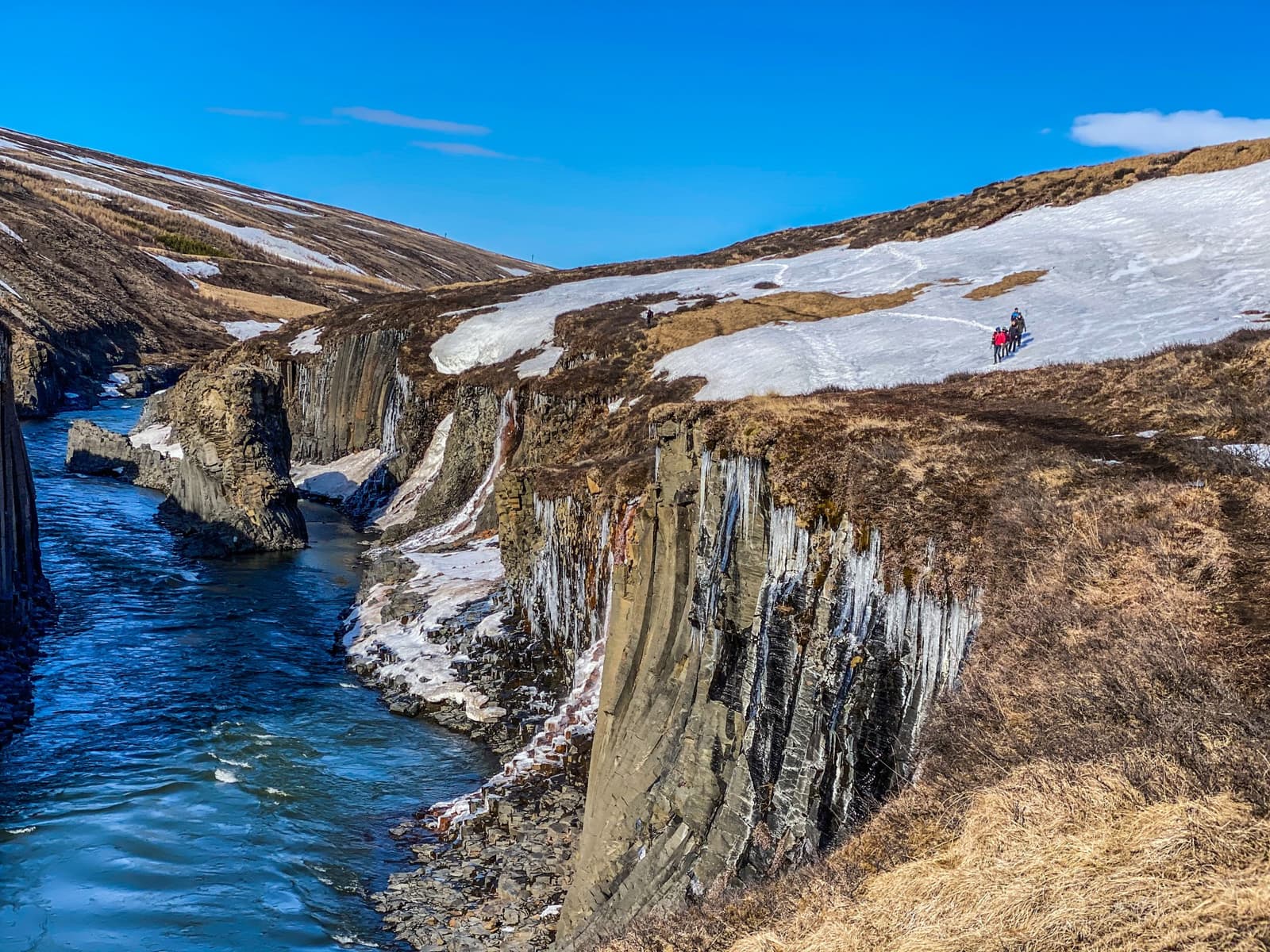
Snow covers the canyon rim in this photograph. Check the current paths and footing; a winter view does not establish safe access.
If the upper east-side approach is unsuitable or restricted, plan for the longer walk from the bridge parking rather than forcing the drive. Use designated parking and follow posted payment instructions. Check current visitor guidance for platform changes and permitted routes; neither side guarantees a safe descent to the water’s edge.
Check side-specific walking and parking information before choosing your route.
What does the visit actually feel like?
Stuðlagil feels stark rather than lush. The first impression is scale and shape: dark columns, narrow water, raw slopes, and a canyon that looks more graphic than soft.
The basalt is the real signature. Some columns stand almost like organ pipes, others bend and break into tighter patterns, and the gorge changes character depending on whether you see it from above, along the rim, or from lower down.
Snow and ice emphasize the basalt patterns. Stay on permitted paths rather than stepping onto slippery columns for a similar photograph.
The river’s blue-green color is variable. Snowmelt and overflow from Hálslón can increase the flow and sediment, making it look gray or brown. Overflow is often an issue later in summer and autumn, but the calendar does not guarantee clear water.
That unpredictability is not a flaw. In person, the place still works because the canyon has strong structure even when the color is quieter. Go for the geology and the route value first, then enjoy the river if conditions cooperate.
Walking time, Road 923 and the return journey
Separate the drive from time at the canyon. The east-side hike takes much longer than the Grund platform visit, especially if you start from the bridge parking.
Visit Austurland’s route guide allows roughly two to three hours for the 5 km return walk, including pauses at Stuðlagil and Stuðlafoss. The approximately 10 km bridge-parking version needs substantially more walking time. Add the Road 923 drive and a margin for slower footing.
Allow time for the version you choose
Grund platforms
A shorter viewpoint visit; allow extra time if using lower signed paths or stairs.
Upper east-side parking
About 5 km return; roughly 2–3 hours with canyon and waterfall pauses in suitable conditions.
Bridge parking
About 10 km return; plan a longer outing with enough daylight for the walk back.
A snowy overhead view shows the narrow gorge. River color, walking conditions and available viewpoints can differ when you visit.
Road 923 is the gravel approach from the Ring Road. Check its current conditions and the final parking access before setting out. Wind, ice, mud and poor visibility can change both the driving and walking time; treat winter access as conditional.
River safety and current access at Stuðlagil
Check more than the weather app. Side-specific visitor details, road service, trail condition, and glacial-river safety all matter more here than at a normal overlook.
Read official visitor information if your plan depends on a specific side, shorter walk, or closer canyon access.
Check official road conditions before you commit to the Route 923 approach, especially outside stable summer conditions.
Use official weather guidance for wind, precipitation, and visibility before exposed walking.
Do not enter the Jökla or improvise a river crossing; a calm-looking surface can hide a strong current.
Stay on marked trails, respect nesting birds and farm activity, and follow signs and barriers around the canyon.
Stuðlagil works best when the rest of the day makes sense around it. Treat it as part of an East Iceland cluster, not as a lonely checkbox between far-apart overnights.
Egilsstaðir is the clearest base for most travelers because it lets you build a canyon day without turning the return drive into a punishment. From there, Skriðuklaustur and Hallormsstaðaskógur add culture and forest contrast if you want a more varied route instead of only chasing viewpoints.
If the day needs another strong scenic anchor, Hengifoss is the obvious comparison. That pairing only works when you genuinely have time for two committed stops, not when you are trying to make East Iceland disappear into the background of a rushed Ring Road itinerary.
That is the real planning question: does your trip have enough East Iceland space to justify the canyon properly? If the answer is yes, Stuðlagil becomes one of the most memorable named stops in the region. If the answer is no, let the route stay simpler and save the detour for a slower trip.
Which side of Stuðlagil is better for most travelers?
Choose Grund’s west-side platforms for a shorter viewpoint visit. Choose the Klaustursel east-side approach for a longer walk. On the east side, the parking by the bridge means about 10 km return; the upper parking near Stuðlafoss means about 5 km return when its access road is suitable.
Do you need a lot of time for Stuðlagil Canyon?
The 5 km eastern return walk can take roughly two to three hours with canyon and waterfall pauses in suitable conditions. Starting by the bridge makes it about 10 km return. Add the Road 923 drive, and leave extra time for weather and uneven footing.
Is Stuðlagil still worth visiting if the river is not bright turquoise?
Yes. The canyon remains worth visiting because the basalt walls and gorge shape are the real identity of the place, even when the river color is more muted.
What should matter most before you commit the stop?
Side choice, road conditions, and footing matter most. If those do not line up with your day, Stuðlagil stops being a highlight and starts becoming a squeeze.
The pin marks Stuðlagil Canyon, not a selected parking area. Choose the Grund west-side platforms or the Klaustursel east-side hiking approach, then check the relevant parking road and walking distance before setting out.
Region
East Iceland
Works well with
Ring Road
Useful base
Egilsstaðir
Interactive planning map for Stuðlagil Canyon
Interactive map
Load the map when you need it
Place context and external map links remain available without loading it.
Nearby places
Decide what else is close enough
Use nearby places to keep a short stop useful without inflating it into the center of the day.