Hraundrangi is a 1,075 m rock spire above Öxnadalur in North Iceland. See its narrow silhouette from the valley, walk below the ridge toward Hraunsvatn, or arrange a separate technical climbing day.
Hike facts
Type
Rock spire, 1,075 m above sea level
Location
Öxnadalur, west of Akureyri
Walking option
Hraunsvatn via Drangabollar: allow about 4 hours
Route closure
The yellow-marked Hraunsvatn route via Háls is closed
Summit
Technical climbing with specialist equipment
In this guide
Hraundrangi above Öxnadalur
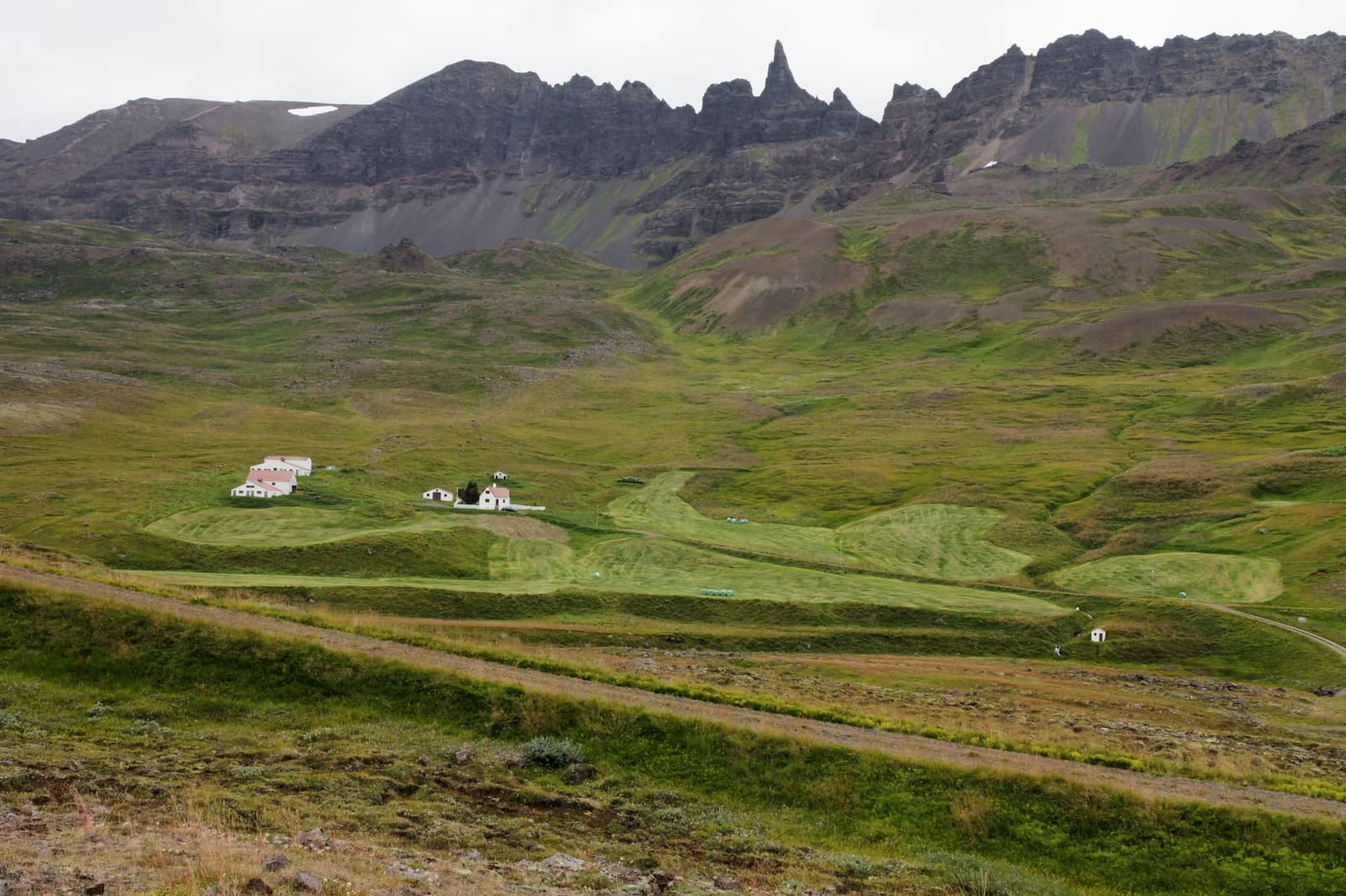
Hraundrangi rises to 1,075 m above sea level on the Drangafjall ridge. Its needle-like shape is the landmark to look for when crossing Öxnadalur on Route 1.
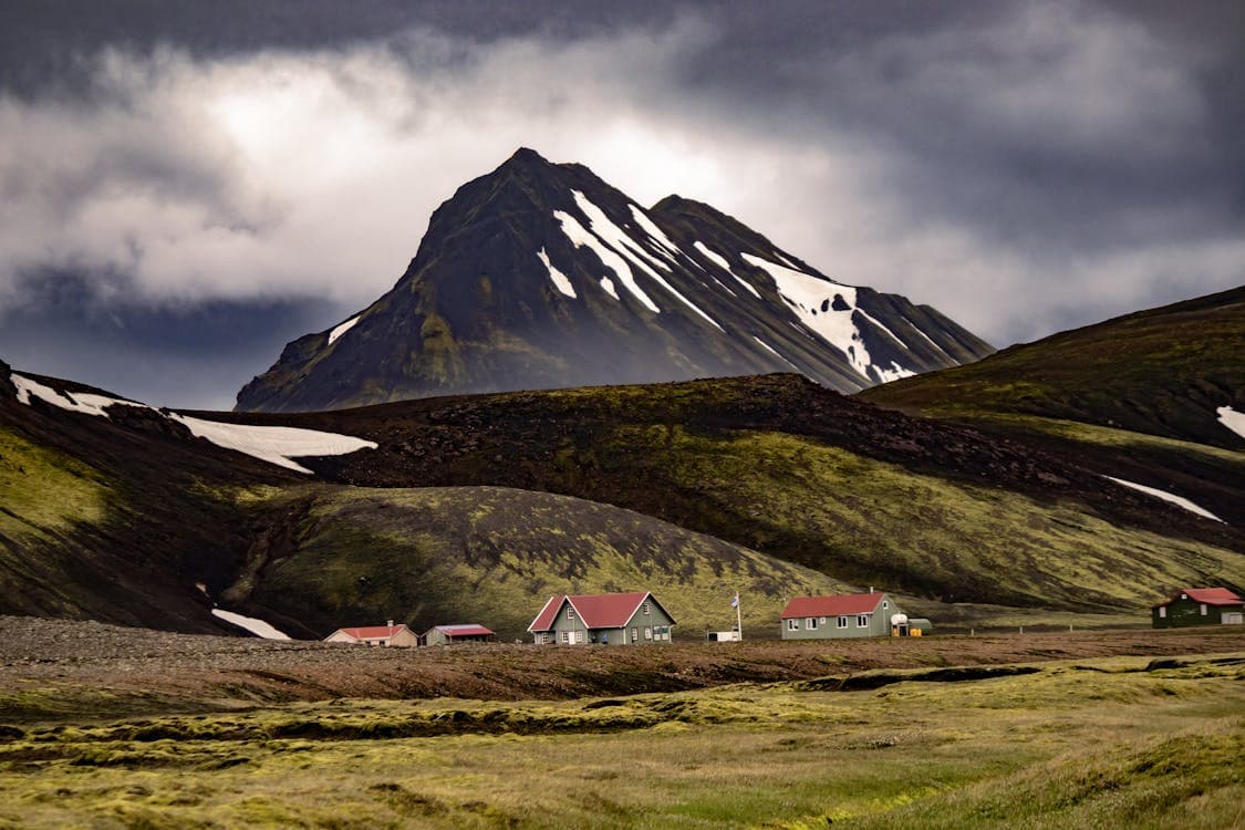
An ancient landslide left the narrow ridge and spire above the valley and helped form Hraunsvatn. From below, the contrast between the rock tower, the farms and the broad valley is the main attraction.
Most visitors come for the view. If you want to walk closer, the Hraun-area trails offer a separate outing below the ridge. Reaching the summit requires technical climbing.
What the Drangafjall spire looks like from below
Hraundrangi is the narrow point that breaks away from the Drangafjall skyline. From below, the appeal is not a broad panorama but the strange proportion of the spire, the steep ridge, and the farm-and-valley scale beneath it.
On clear days the peak reads almost like a natural tower, which is why it attracts photographers even when they have no intention of climbing. Cloud, low light, and snow can either sharpen the silhouette or hide the point completely.
That visual drama is also the trap. A peak that looks close from the road can still mean uneven ground, changing mountain weather, and a much more serious decision if you leave the valley floor.
Snow and cloud can make the spire more striking, but they also raise the stakes for any plan beyond a valley view.
Walking from Hraun toward Hraunsvatn
Visit Akureyri describes several walks from Hraun with different demands. Its red-marked route via Drangabollar to Hraunsvatn is listed at about four hours and rated challenging; allow for your pace and conditions.
Visit Akureyri lists the yellow-marked route to Hraunsvatn via Háls as closed. Older hiking brochures may still show it as route 2. Check the current Hraun hiking information and signs before choosing a route.
Hraunsvatn and the Hraunsá river give a closer view of the ridge. The valley also has a literary connection: poet and naturalist Jónas Hallgrímsson was born at Hraun in Öxnadalur.
Check route 2 via Háls and route 3 via Drangabollar before setting out.
The Hraun side is the practical non-climber's context: farm landscape, valley scale, and the ridge above.
What a Hraundrangi summit climb involves
The summit requires exposed rock climbing, ropes, a harness and a helmet. North Ice Expeditions describes a guided outing lasting about seven to nine hours, including the mountain approach.
The usual guided climbing approach is from Hörgárdalur, on the other side of the ridge from Hraun. The Hraun walking routes are not directions to the start of that climb. Confirm the meeting point, equipment, experience requirements and weather decision with a qualified guide.
Compare walking options at Hlíðarfjall and Kjarnaskógur if technical climbing is beyond your experience. Both belong to the wider Akureyri area and give you other ways to spend time outdoors.
The Hraun walking routes and the usual Hörgárdalur climbing approach start on different sides of the ridge.
Use the operator’s current approach, duration and equipment information when considering a climb.
Fitting Hraundrangi into an Akureyri-side day
Hraundrangi belongs best in a North Iceland day that already has Akureyri or Öxnadalur in the plan. It is less convincing as a stand-alone detour from far away, because the payoff depends heavily on visibility and how much walking you actually want.
From Akureyri, use it as a weather-flexible mountain option: stop for the view, walk toward Hraunsvatn if the day suits it, then keep an easier backup nearby. Goðafoss, Mývatn, and Siglufjörður are stronger route anchors when you need a full North Iceland sightseeing day.
If you are only passing through on Route 1, keep the stop simple. The valley view can be enough, and forcing a climb or long walk into a tight drive can make the day worse rather than better.
For many self-drivers, Hraundrangi sits inside the broader Öxnadalur road scene rather than becoming the day's main destination.
Access, parking and weather checks
Follow current signs and parking guidance at Hraun for the walking routes. The mountain location pin identifies Hraundrangi; it is not a verified parking bay or the meeting point for a guided climb.
Check the current Hraun route list, including the closure via Háls, and respect any local access restrictions.
Check official road information if winter weather, wind, or mountain passes could affect the drive.
Check the weather forecast before committing to exposed terrain or a photography plan.
Confirm operator details before booking a technical climb or relying on guide availability.
Use a lawful stopping place for photographs; keep Route 1 and farm access clear.