
Town snapshot
- Type
- Remote village and industrial heritage stop
- Region
- Reykjarfjörður in Strandir, Westfjords
- Best use
- Slow Westfjords day with real route margin
- Time
- 45 minutes to half a day
- Standout
- Factory ruins, waterfall, and fjord silence
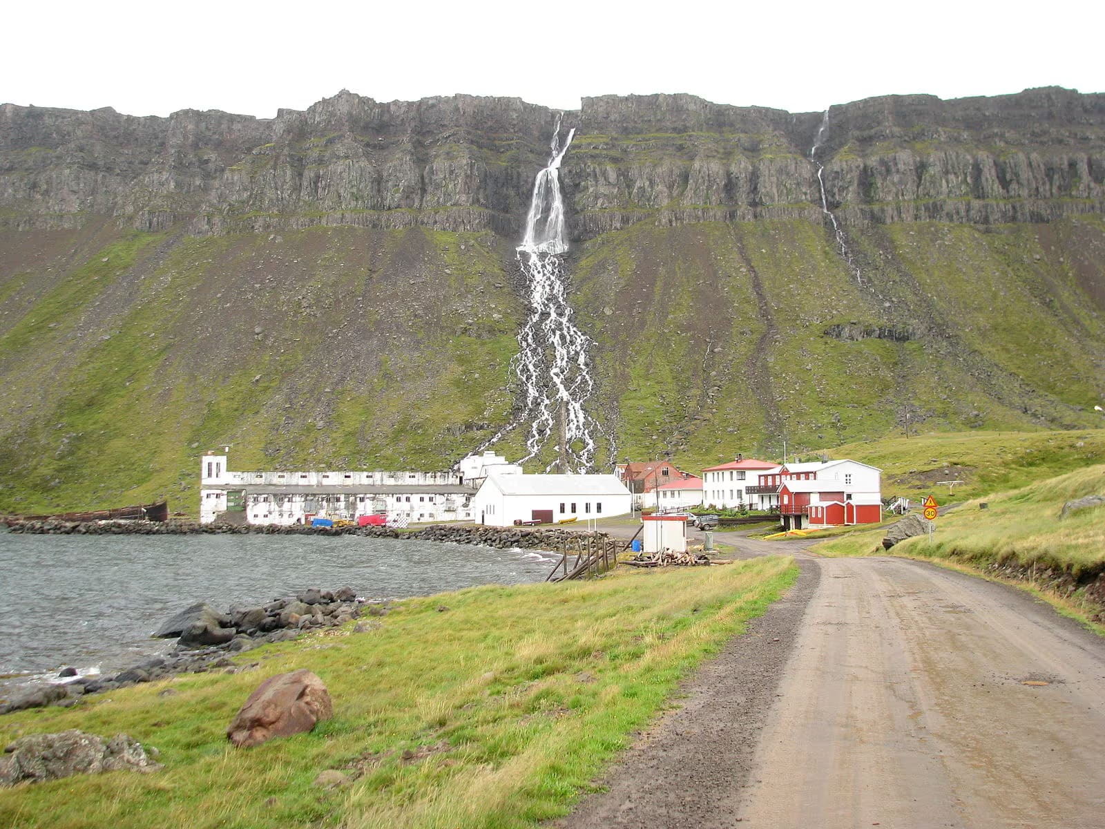
Djúpavík is a remote Strandir village that earns the long drive when you want industrial history, a dramatic waterfall backdrop, and enough Westfjords time to let the place feel haunting, quiet, and specific rather than just far away.
Town snapshot
Usually yes when Strandir itself is the point. Usually no when you only want one more famous stop and the extra road north would hollow out the rest of the trip.
Djúpavík is one of those places that feels stronger in memory than on a checklist. The village is tiny, but the combination of a huge abandoned herring factory, the waterfall dropping behind it, and the near-empty fjord setting gives the stop a shape that is hard to confuse with anywhere else in Iceland.
That does not make it a universal detour. If your Westfjords plan still struggles to fit basics like Hólmavík, a realistic overnight, or the route north toward Krossneslaug, Djúpavík can become expensive scenery. It works best when the whole Strandir side of the trip is already deliberate.
You do not arrive at a neat village center. You arrive at a tiny settlement pressed between the fjord and steep dark cliffs, with the old factory and waterfall reading almost as one scene.
That setting is the first reason Djúpavík works. The road narrows the world down to one bay, one strip of buildings, one huge industrial shell, and one wall of rock and water above it. It feels exposed but not empty, because the surviving houses and hotel still hold the place together.
Compared with Drangsnes, which feels more like a working shoreline village, or Trékyllisvík, which opens as a broader cove, Djúpavík is more theatrical. The village is small, but the backdrop is oversized enough to make a short walk feel like a real arrival.
The factory is not just a photogenic ruin. It is the main reason the village has a specific story rather than only a remote atmosphere.
The first herring venture started here in 1917 and failed quickly, but a much larger concrete factory went up in the 1930s and reshaped the settlement before the operation finally closed in 1954. That history still explains the scale mismatch travelers notice immediately: a tiny village beside a building far larger than the place now seems to need.
That is also why Djúpavík has more depth than a roadside abandoned-building photo. Regional tourism material describes the factory as an exhibition building today, and the former women workers' quarters now serve as the hotel. If you want the interior or any guided interpretation to be part of the stop, confirm the latest details directly rather than assuming access on the day.
The waterfall above the village is the clearest reason to give Djúpavík more than a quick exterior look.
Visit Westfjords lists both the waterfall and the marked Djúpuvíkurhringur loop as part of the place. That matters because the page should not flatten Djúpavík into industrial heritage only. There is a second, more active version of the stop where you walk above the old buildings and read the fjord from higher ground.
The official trail description gives the loop a 2 to 3 hour duration, mixed ground, and clear hazard notes near steep edges and possible rockfall. That makes it a real planning choice, not an afterthought. If the weather is wet, windy, or low on visibility, the village-and-factory version of Djúpavík may be enough.
The cleanest way to use Djúpavík is inside a Strandir chain, not as an isolated pin far north of everything else.
Most travelers should think in route anchors. Hólmavík gives the south end of Strandir a practical harbor base and a culture layer through The Museum of Icelandic Sorcery and Witchcraft. Bjarnarfjörður in Strandir and Drangsnes make better early pairings than racing straight north with no slack in the day.
| Trip shape | When Djúpavík helps | When it weakens the day |
|---|---|---|
| Slow Strandir day | You want one strong industrial-history stop before continuing toward Trékyllisvík or Krossneslaug. | The day already holds too many northbound stops to give the village any time. |
| Westfjords sampler | You have real margin and want one remote place that feels different from classic waterfall or cliff anchors. | You still have not settled stronger priorities elsewhere in the region. |
| Culture-leaning route | You want the factory story to sit beside Hólmavík's folklore and museum angle. | You are only chasing scenery and will not engage with the history at all. |
North of Djúpavík, Krossneslaug is the clearest payoff if the day keeps going. If your time is limited, that comparison is useful: Djúpavík adds story and setting, while Krossneslaug adds a destination-like end point.
Djúpavík is too remote for fixed assumptions. The final go or skip call should come from official road, weather, safety, and local visitor information.
Broad place identity, route context, and nearby local references.
Marked-loop duration, terrain notes, and hazard context.
Road 643 section relevant to the Djúpavík approach.
Use with SafeTravel before a remote north Strandir day.
By ThorPublished Updated
Map
Use nearby places and useful bases before opening directions.
Interactive planning map for Djúpavík
Interactive map
Place context and external map links remain available without loading it.
Planning context
Open the region or practical guide that resolves the next planning decision.
Wider route
Use broader place relationships for route comparison; they are not presented as immediate nearby stops.
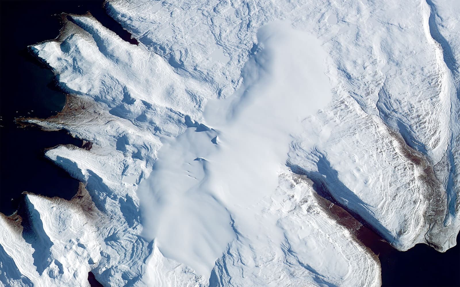
Drangajökull is the only glacier in the Westfjords, best planned as a remote landscape stop where Kaldalón access, road conditions, weather, and wider Westfjords time decide whether the detour is worthwhile.
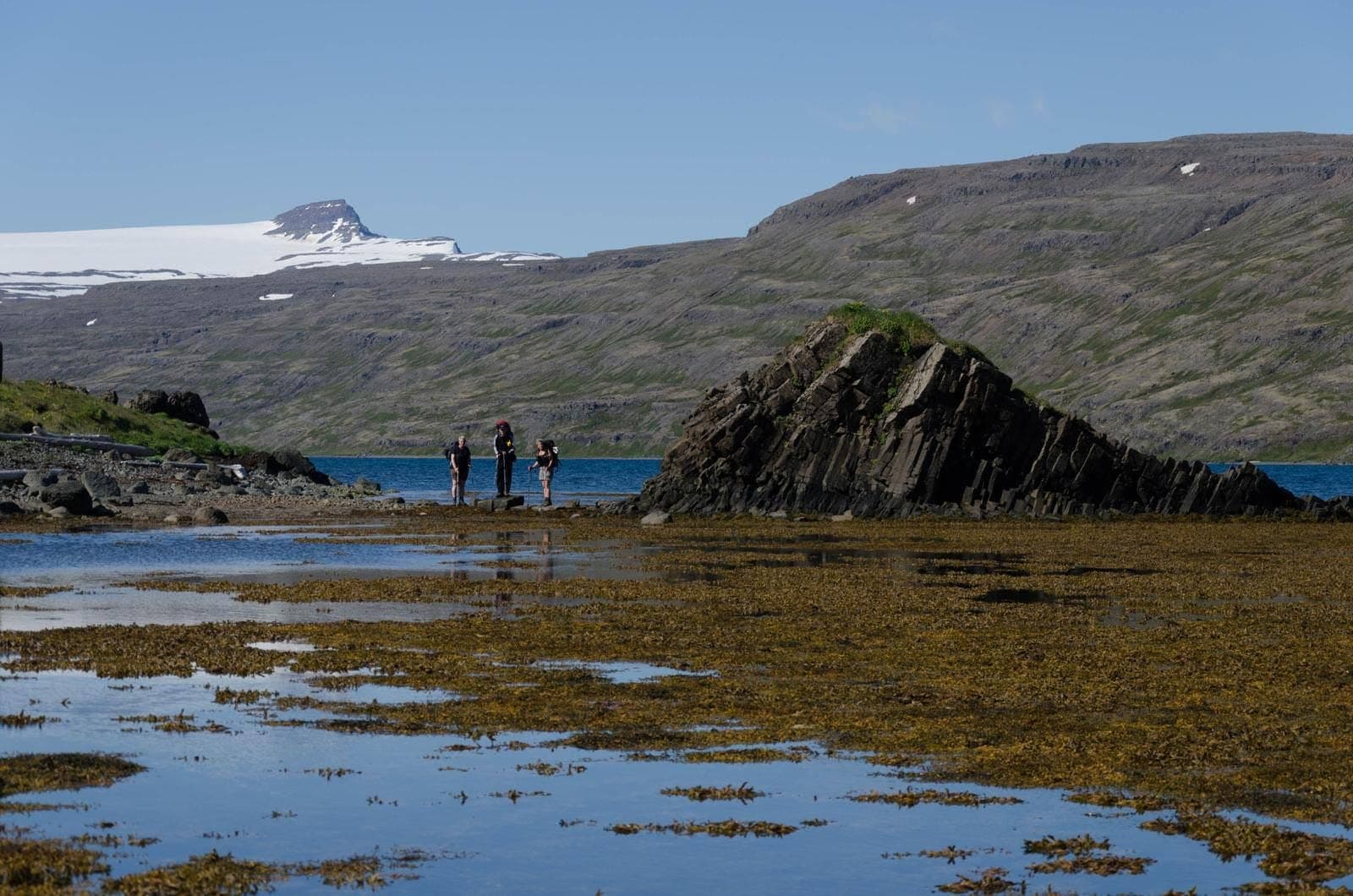
Hrolleifsborg is a remote Westfjords mountain near Drangajökull, best for experienced planners who want wild hiking context and broad fjord views, not a casual stop on a tight Iceland route.
