
Coast snapshot
- Type
- Alternate name for Breiðavík bay
- Region
- Southern Westfjords
- Role
- Name clarity near Látrabjarg
- Access
- Road 612 context
- Best for
- Quiet beach pause
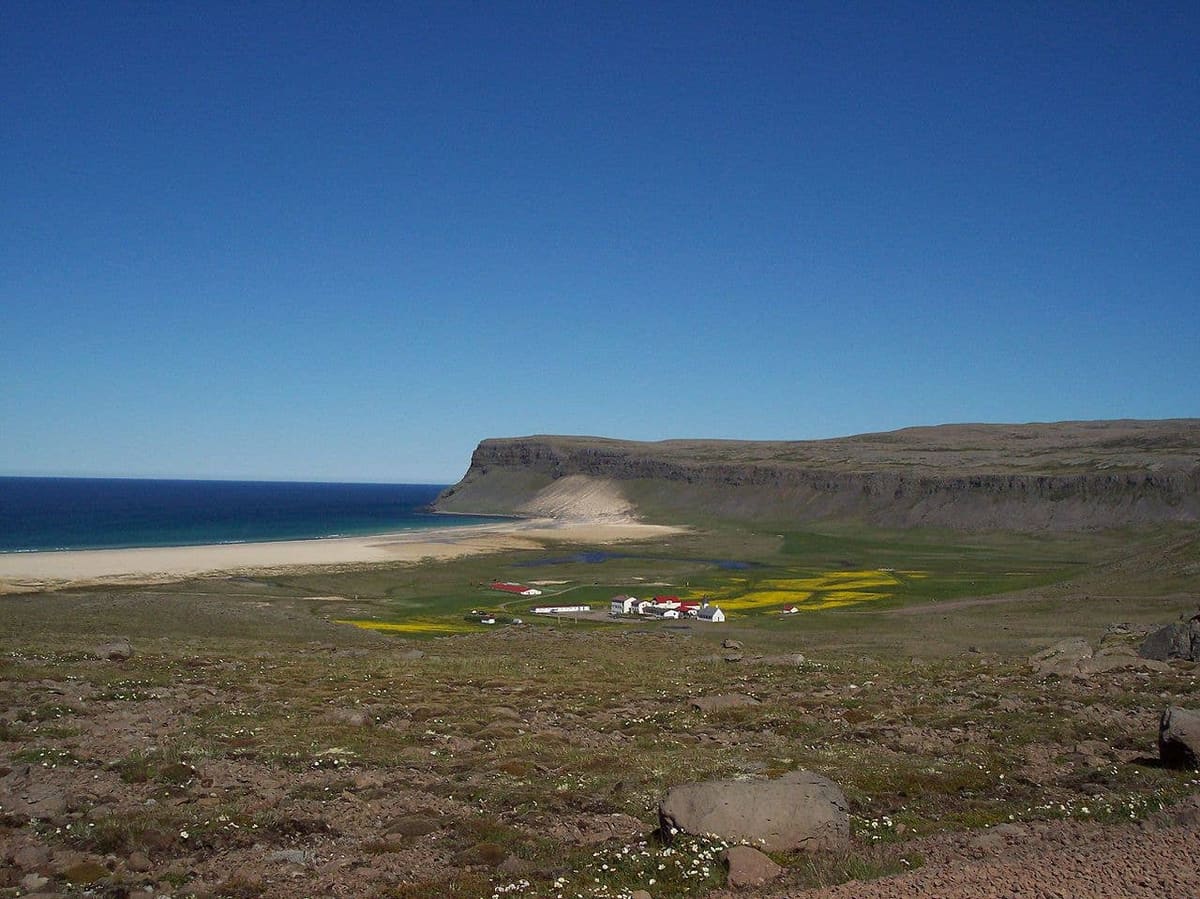
Breidavik Bay helps travelers who meet the English name understand the same Breiðavík beach and bay area near Látrabjarg, decide whether it deserves time, and avoid planning it as a second separate attraction.
Coast snapshot
Breidavik Bay is best understood as the English label for the Breiðavík beach and bay area on the Road 612 approach to Látrabjarg.
If you already have Breiðavík in your plan, do not add Breidavik Bay as another separate attraction. The name points travelers toward the same broad golden-sand bay, low settlement, church, and nearby services below the Látrabjarg route.
This page is useful because the English wording appears in travel listings and maps. It helps you connect the label to the real place, decide whether the bay deserves time, and avoid double-counting one quiet Westfjords stop.
The geographic clue is Road 612: Breiðavík sits on the way to Látrabjarg after the approach from Örlygshöfn.
Visit Westfjords describes Breiðavík as a place you reach when driving over the mountain pass from Örlygshöfn toward Látrabjarg. That is why the bay works best as a pause within a western Westfjords driving day, not as a stand-alone destination from far away.
The useful sequence is usually simple: decide first whether Látrabjarg is worth the drive for your route, weather, and daylight. If it is, Breidavik Bay becomes a calm beach-and-settlement pause before or after the cliffs.
The place is a wide coastal setting rather than a staffed attraction: sand, slopes, church, scattered buildings, and Atlantic weather.
The bay is not valuable because it has a long checklist of built attractions. Its appeal is the softer color of the sand, the open beach, the church and buildings, and the way the land opens out before the much sharper drama of the bird cliffs.
Nearby operators and accommodation can make Breiðavík a useful base for some travelers, but that is different from guaranteed public facilities. Confirm current details before you depend on food, camping, rooms, activities, or services.
Most travelers do not need every beach in this corner. Choose based on route pressure, weather, and what kind of stop the day can absorb.
| Place | Use it when | Planning caution |
|---|---|---|
| Breidavik Bay | You are already heading to Látrabjarg | Do not count it separately from Breiðavík |
| Rauðasandur | You want a larger beach detour | Needs more time and conditions margin |
| Örlygshöfn Beach | You need a quieter route-context pause | Best when it fits the same driving line |
Use Rauðasandur when the beach itself is a larger goal. Use Örlygshöfn Beach when you are comparing smaller coastal pauses on the approach. Use Breidavik Bay when the name you found simply needs to be matched to Breiðavík.
The bay is simple; the access and conditions are the planning risk. Check official information before turning the name into a fixed itinerary promise.
Road, weather, and visibility matter more than the map distance suggests. Before driving west, check official road conditions, the Westfjords forecast, SafeTravel guidance, and any operator information that affects your plan.
At nearby Látrabjarg, protected-area rules and cliff-edge safety also matter. If the bay is part of a cliff day, keep the full outing flexible enough to respect barriers, nesting-season guidance, wind, fatigue, and changing conditions.
By ThorPublished Updated
Map
Use nearby places and useful bases before opening directions.
Interactive planning map for Breidavik Bay
Interactive map
Place context and external map links remain available without loading it.
Planning context
Open the region or practical guide that resolves the next planning decision.
