
Waterfall facts
- Type
- Village-edge waterfall
- Region
- South Iceland, above Kirkjubæjarklaustur
- Best for
- A short Klaustur pause
- Time
- About 20 to 45 minutes
- Access
- Short view, steeper lake path
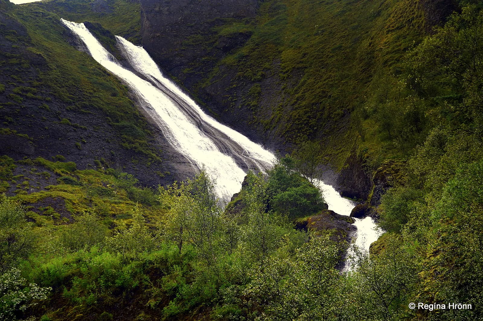
Systrafoss is a village-edge waterfall above Kirkjubæjarklaustur, useful for travelers who want a quick South Coast pause, a short local walk, or a little Sisters-history context without overselling it as a major detour.
Waterfall facts
Systrafoss is most useful when Kirkjubæjarklaustur is already in your South Coast plan. The waterfall gives the village a scenic pause, but it should stay proportionate.
The falls drop from the hillside above Kirkjubæjarklaustur, close enough to work as a quick leg-stretcher between longer South Coast drives. If your day is already packed between Vík and the glacier-lagoon area, treat Systrafoss as optional rather than essential.
The best reason to stop is not raw waterfall scale. It is the compact mix of water, village, hillside, and local names that makes Klaustur feel like more than a fuel-and-overnight point.
Systrafoss often reads as two pale streams sliding down a dark, green hillside rather than one heavy plunge.
The waterfall comes from Fossá, which flows down from Systravatn above the village. From below, the appeal is the way the narrow water lines sit above houses, grass, and the lower gorge, especially when the flow is strong enough to show both strands clearly.
That also means the visit can feel different from season to season or even after a dry spell. Do not build the day around a guaranteed dramatic flow; use it as a flexible Klaustur-area stop.
The useful extra context is above and below the waterfall: Systravatn feeds Fossá, while Fossasteinn gives the lower gorge a memorable local landmark.
Visit Klaustur and Visit South Iceland both connect Systrafoss with Systravatn, the lake on the mountain edge. If your group wants more than a photo, the lake path and viewpoint turn the waterfall into a small local walk rather than a roadside glance.
The same local landscape includes Fossasteinn, a large rock in the gorge, and the Sisters naming that ties Systrafoss, Systravatn, and Systrastapi to Kirkjubæjarklaustur's convent history. Keep that as context, not as a reason to force the stop into every itinerary.
Most travelers should allow about 20 to 45 minutes unless they are deliberately adding the uphill lake path.
A lower viewpoint and short village pause can be quick. The visit becomes more involved if you climb toward Systravatn, wait for better light, or combine the waterfall with local stops such as Kirkjugólf and Stjórnarfoss Waterfall.
| Situation | Decision | Why |
|---|---|---|
| Overnighting in Klaustur | Add it | The waterfall is close and gives the village a scenic walk. |
| Passing through with spare time | Pause briefly | It is easy to sample without reshaping the day. |
| Rushed Ring Road schedule | Keep moving | Nearby stronger sights may deserve the limited daylight. |
| Wet, icy, or windy conditions | Shorten the walk | The hillside path is less useful when footing or visibility is poor. |
Systrafoss works best as part of a small Klaustur cluster, not as one more waterfall added to an already crowded South Coast checklist.
For a local loop, pair it with Systrastapi, Kirkjugólf, or Stjórnarfoss. For a stronger landscape decision, compare the time against Fjaðrárgljúfur, which usually offers a bigger canyon payoff when access and conditions make sense.
Before relying on the stop, check weather, road conditions, and local visitor information. Facilities, paths, and comfort can vary with season, maintenance, daylight, and weather.
Use for local place context and visitor information.
Use for Systravatn, Fossasteinn, and nearby South Coast context.
Check South Iceland driving conditions before route-dependent stops.
Check warnings, wind, precipitation, and visibility.
By ThorPublished Updated
Map
Use nearby places and useful bases before opening directions.
Interactive planning map for Systrafoss Waterfall
Interactive map
Place context and external map links remain available without loading it.
Planning context
Open the region or practical guide that resolves the next planning decision.
