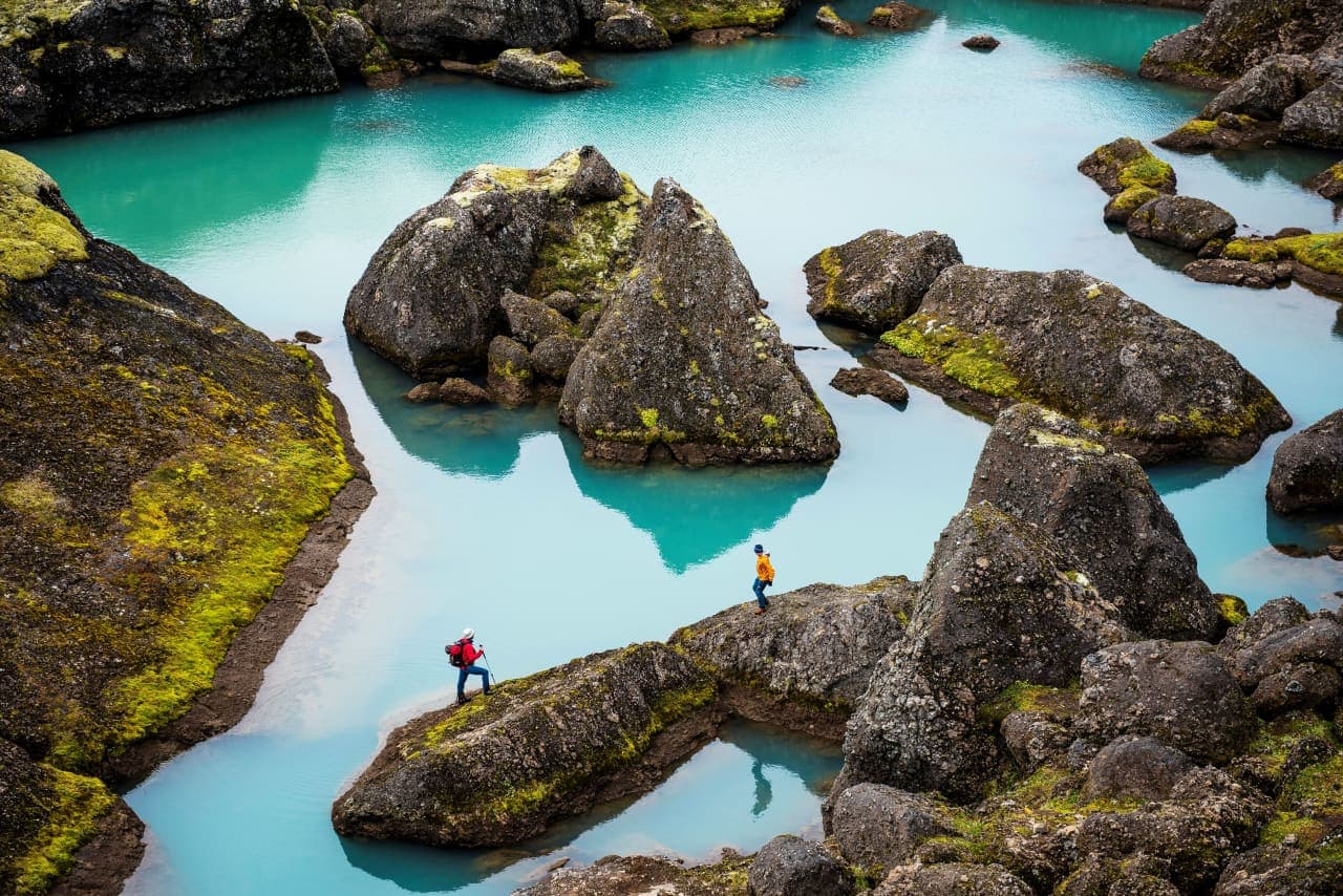
Stórurð is a high boulder valley below Dyrfjöll, where giant blocks, blue-green ponds and grassy flats reward prepared hikers who can give suitable East Iceland conditions a full mountain day.
Hike facts
Walking time
About 4-5 hours return; treat it as a day outing
Elevation
Urðardalur lies more than 400 m above sea level
Routes
Five marked trails; Vatnsskarð is the most-used start
Usual season
About mid-July until the first appreciable autumn snow
Giant rocks and still water fill the valley below Dyrfjöll
Stórurð is a landscape to walk into, not a viewpoint beside the road.
At the foot of Dyrfjöll, enormous blocks of tuff and volcanic breccia lie across a high green valley. They collapsed onto a cirque glacier, moved down-valley with the ice and were left behind as the last Ice Age ended roughly 10,000 years ago. Blue-green ponds and narrow passages now sit between the rocks.
The combination is the reason to hike here: mountain scale, unusually still water and a boulder field that feels enclosed once you enter it. This is a distinct destination within the wider Dyrfjöll landscape rather than a generic mountain walk.
Photo guide
Stórurð in photos
1 / 4
The approach crosses open mountain ground below Dyrfjöll before reaching the boulder valley.
Five marked trails reach Stórurð
The common Vatnsskarð approach is only one option, so choose the route from the official trail information rather than an improvised track.
Two marked trails begin at Vatnsskarð, one comes from Njarðvík and two connect from Borgarfjörður Eystri. Vatnsskarð is the most-used start. Visit Austurland estimates about 4-5 hours for the return hike and recommends treating it as a day outing.
The scale becomes clear inside the boulder field, where marked passages thread between rocks and ponds.
The official descriptions do not support one universal distance or ascent figure for all five approaches. Urðardalur itself is more than 400 m above sea level, and the walking is over uneven mountain ground rather than a surfaced path. Use the current marked-route information to choose a start that fits your transport and experience.
Approaches, elevation, timing and Road 94 context.
Snow and exposure narrow the useful season
Mid-July to the first appreciable autumn snow is the normal window described by the local visitor authority.
Snow often remains well into summer above 400 m. Fog, wind and wet ground can also make route-finding and footing harder even within that usual window. The trail is a poor place to force a fixed itinerary when the mountain is obscured or warnings are active.
Check Route 94 on Umferðin and review the Met Office forecast and SafeTravel alerts before leaving. Egilsstaðir is a practical base, but the drive does not reduce the need for a full hiking window.
Arrival in the valley does not end the risk: deep gaps can be hidden between the rocks.
Mobile coverage is patchy, so tell someone your plan and keep to the marked trails. Inside Stórurð, the official local guidance identifies the marked circuit as the safest line. Move carefully around concealed holes, resist shortcuts through the rocks and turn back if snow or visibility makes the markings hard to follow.
The calm ponds sit among deep gaps and oversized rocks, so the marked circuit matters even after the main approach.
Carry the clothing, food and navigation backup expected for several hours in exposed terrain. The right visit is unhurried: enough time to reach the ponds, follow the circuit carefully and return without racing fading light or the next drive.