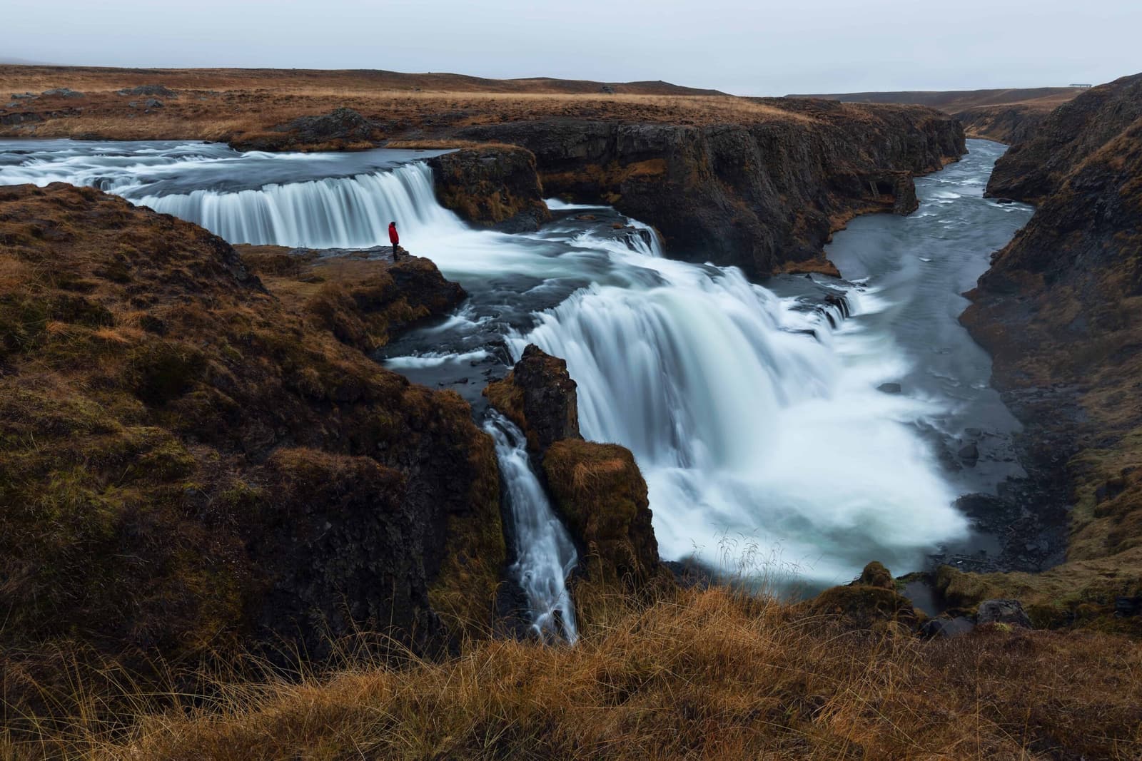
Reykjafoss is a tiered waterfall near Varmahlíð in Skagafjörður, beside Fosslaug hot spring. The landowner announced an access closure in June 2026, so confirm reopening before planning a walk to either place.
Waterfall facts
Type
Tiered waterfall beside Fosslaug hot spring
Location
About 7 km from Varmahlíð in Skagafjörður
Access
Landowner announced closure on June 29, 2026; reopening unconfirmed
Planning
Confirm access before visiting the waterfall or spring
In this guide
Reykjafoss access closure
Confirm reopening before planning a visit to Reykjafoss. On June 29, 2026, the landowner announced that access to the waterfall and Fosslaug on his land was closed.
Vísir reported the closure after interviewing landowner Dagur Torfason. Heimildin reproduced his statement that general access on his side was closed for the time being. No reopening date was given. This does not establish a permanent closure, but it means an older recommendation to walk in is insufficient.
The restriction names Fosslaug Hot Spring as well as the waterfall. Do not use one as a way around the other’s access restrictions, and do not enter across a fence or closed gate.
The announcement concerns access on the owner’s land; it gives no reopening date.
Photo guide
Reykjafoss Waterfall in photos
The wider river view explains why the stop feels rural even though it sits close to Varmahlid.
The waterfall near Varmahlíð
Reykjafoss is a tiered cascade in open Skagafjörður countryside. Visit Skagafjörður places it about 7 km from Varmahlíð, making the village the nearest useful point for local visitor information.
The retained photographs show separate rocky ledges, chutes and pools rather than a single curtain of water. The wider landscape is farmland and riverbank, with Fosslaug beside the river near the falls. These images explain the place; they do not show whether an approach is authorized.
Reykjafoss drops over several ledges through open Skagafjörður farmland.
Older descriptions focus on a short rural walk. A short distance does not make a closed approach usable. The map pin identifies the waterfall’s location, not verified visitor parking or a permitted trailhead.
Paths, viewpoints and the neighboring spring
Do not rely on old parking instructions or a suggested viewing point while access remains unconfirmed. A parking charge, map listing or photograph of visitors is not a reopening announcement.
If local visitor information confirms that access has resumed, ask which approach is authorized and follow the signs there. No alternative route across adjoining land is verified here. Avoid making a detour simply to see whether a gate can be bypassed.
An earlier visitor photograph shows snowy riverbanks. It does not establish access after the landowner’s closure announcement.
The Fosslaug guide explains the bathing implications. The spring is small and outdoors beside the river, so even a future access change would not by itself establish bathing safety or accessible facilities.
Fosslaug shares the same access restriction; the pool photograph is not confirmation that bathing is available.
Other stops around Skagafjörður
Use Varmahlíð to rethink the day and ask about access. Its local services and municipal pool offer options that do not depend on reaching the waterfall.
For nearby cultural context, look at Glaumbær. If your route already follows the coast, Hofsós is another separate destination to consider. Check each place’s visitor details and travel time before substituting it.
Kolugljúfur Canyon lies farther west, while Goðafoss and Akureyri belong to a longer journey east. They are alternatives for different route segments, not adjacent replacements for Reykjafoss. Use the North Iceland guide to compare those broader route choices.
Access across the landowner’s property to Fosslaug and Reykjafoss was closed on June 29, 2026. Confirm reopening before planning a visit; the location pin is not an approved arrival point.
Region
North Iceland
Works well with
Ring Road / Arctic Coast Way
Useful base
Sauðárkrókur
Interactive planning map for Reykjafoss Waterfall
Interactive map
Load the map when you need it
Place context and external map links remain available without loading it.
Planning context
Use the wider destination guides
Open the region or practical guide that resolves the next planning decision.