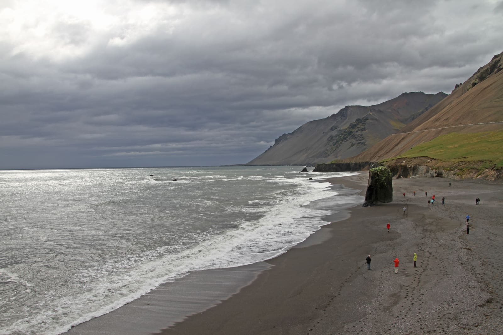
Fauskasandur is a black-sand shore beside Route 1 between Höfn and Djúpivogur. The nearby sea-stack view is also known as Stapi in Lækjavík; allow a short coastal stop when wind, surf and visibility make it sensible.
Coast snapshot
Type
Black-sand beach with sea stack
Region
East Iceland coast south of Álftafjörður, between Höfn and Djúpivogur
Best use
Short scenic Ring Road pause
Time
Suggested allowance: about 20–45 minutes in suitable conditions
Nearby
Hvalnes Lighthouse and Eystrahorn
In this guide
Fauskasandur on the east-coast drive
The coast between Höfn and Djúpivogur combines dark sand, surf and steep mountain slopes close to Route 1. Fauskasandur suits a short break when the weather leaves room to enjoy the shore.
Look beyond the black-sand label: the upright rock near the water and the scree-covered slopes are what make the nearby coastal view recognizable. Allow time to stop safely, check the approach and look at the sea before deciding whether to walk down.
The best reason to stop is simple: you want one short beach-level pause near Hvalnes Lighthouse and Eystrahorn, without turning the route into a long detour. If the day already feels crowded, this is one of the first optional stops to cut.
The sea stack at Lækjavík
Names differ between travel guides and map listings. Visit Austurland calls the prominent sea stack Stapi in Lækjavík, or Stapinn í Lækjavík, and places it on Route 1 south of Álftafjörður.
The tourism authority describes the stack as about 20 metres high. The photographs here show that sea-stack coast, commonly pictured in guides to Fauskasandur. A beach pin and the sea-stack viewpoint are not interchangeable arrival points.
Hvalnes and Eystrahorn are separate stops farther along this stretch of coast. Brunnhorn, nearer the Höfn end of the journey, is another mountain landscape rather than the name of the slope behind this beach.
The dark shore and nearby sea stack share a backdrop of steep coastal slopes.Visit Austurland identifies this coastal rock as Stapi in Lækjavík.
Allowing time for the shore
A suggested allowance is 20–45 minutes for views and a short walk in suitable conditions. This is a planning estimate, not a measured walking route.
Use 20 to 30 minutes when you only want the view, a short walk, and a few photos.
Stretch closer to 45 minutes when the surf, light, and mountain visibility make the beach worth lingering on.
Cut it from the plan when the day already depends on reaching Höfn or Djúpivogur on time.
The beach lies below the road. A short approach can still involve sloping, loose or slippery ground, so judge the descent and return before committing. Do not assume a step-free path or a maintained winter approach.
View the cliffs from a safe distance; avoid standing directly beneath them.
Hvalnes and Eystrahorn as nearby stops
Choose one or two coastal stops that fit the day. Allow separate driving and stopping time for the beach, lighthouse and mountain viewpoints.
Use Hvalnes Lighthouse when you want a neighboring landmark with a clearer man-made focal point. Use Eystrahorn when the mountain viewpoint matters more than a beach-level stop. Use Fauskasandur when you want the coast itself to do the work.
Use the East Iceland guide for the onward journey. On a transfer day, protect the time needed to reach Höfn or Djúpivogur rather than adding every coastal viewpoint.
The coastal road passes above the shore; assess the stopping place and descent separately.
Safe stopping and exposed-coast conditions
The map identifies the named beach, not a verified parking bay. Use a suitable stopping area fully clear of Route 1, follow local signs and leave the stop out if you cannot park safely.
Check official road conditions before you count on any short stop along this stretch of Route 1. Then check weather and travel-condition guidance, because visibility and coastal wind do more to change the payoff here than any map description can.
Stay well away from the water and avoid standing beneath cliffs or on wave-washed rocks. Keep children close and watch the sea while taking photographs. If wind or surf makes the approach doubtful, skip the shore walk; a picture of people near the water is not evidence that it is safe now.
Fauskasandur is on the east coast beside Route 1 between Höfn and Djúpivogur, south of Álftafjörður. The sea stack often shown in photographs of this coast is listed by Visit Austurland as Stapi in Lækjavík.
Is Fauskasandur a black sand beach?
Yes. The shore has dark sand and coarse beach material below steep slopes. For the prominent sea-stack view, also check the Lækjavík name and the local approach before stopping.