Waterfall facts
- Type
- Town-edge waterfall walk
- Region
- Reyðarfjörður, East Iceland
- Best for
- Short local nature pause
- Role
- Waterfall on Búðará route
- Nearby
- Budara Canyon and Wartime Museum
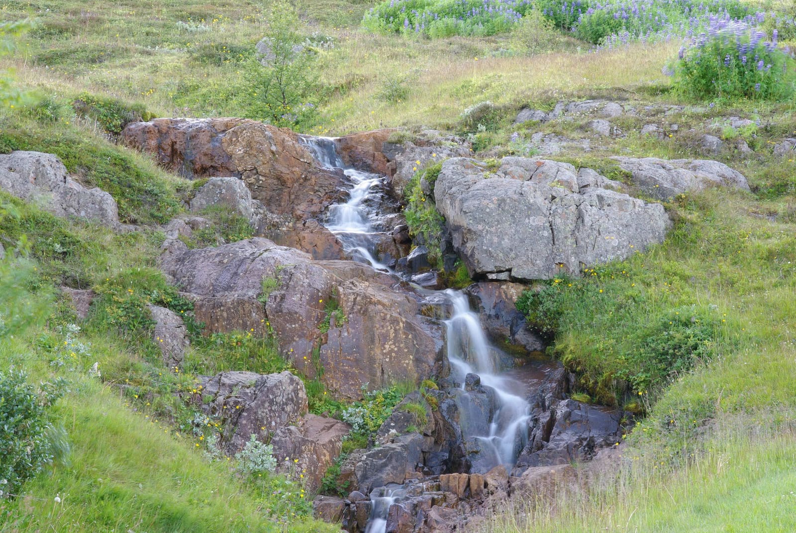
Budararfoss Waterfall helps East Iceland travelers understand the Búðarárfoss waterfall above Reyðarfjörður, decide whether the short Búðará walk is worth adding, and avoid confusing it with similar waterfall names nearby.
Waterfall facts
Budararfoss Waterfall is best treated as the waterfall point on the Búðará walking route above Reyðarfjörður, not as a major standalone East Iceland detour.
The useful decision is simple: if you are already stopping in Reyðarfjörður and want a short nature break above town, Búðarárfoss can be worth the walk. If your day is already stretched between the Ring Road, Hengifoss, fjord driving, or Seyðisfjörður, treat it as optional.
Visit Austurland describes Búðará Canyon and Waterfall as a walking path from the center of Reyðarfjörður. The waterfall is the clear natural payoff on that route, with the Búðará river, Búðarárgil canyon, and town-edge setting giving the stop its real shape.
The waterfall makes most sense when you plan it with the Búðará river and canyon, not as a separate pin to chase between larger sights.
The official regional description places the route from Reyðarfjörður town up Búðarárgil along the Búðará river. It also notes the Icelandic Wartime Museum nearby and the old electricity-dam context above the waterfall, which makes the walk feel connected to town rather than isolated in the mountains.
That context changes how long you should give it. There is no need to force a fixed sightseeing slot. Let the stop expand if the weather is calm, the path feels straightforward, and the town pause is already working; shorten it if footing, wind, daylight, or route pressure makes the walk feel marginal.
Búðará and Búðarárfoss names can point travelers toward more than one East Iceland waterfall context, so confirm the town before navigating.
This page uses the Reyðarfjörður identity: Búðarárfoss above town on the Búðará route. Search results and maps can also surface a similarly named Búðarárfoss or Budareyrarfoss above Seyðisfjörður, which is a different fjord and a different planning decision.
If your base is Egilsstaðir and your day already includes Seyðisfjörður, check whether you actually mean the Seyðisfjörður hillside waterfall instead. If your plan is built around Reyðarfjörður, Eskifjörður, or the central Eastfjords coast, the Búðará walk is the relevant local context.
| Map clue | Likely place | Planning meaning |
|---|---|---|
| Reyðarfjörður, Búðará, Búðarárgil | Budararfoss Waterfall | Short town-edge river and waterfall walk |
| Seyðisfjörður, Búðareyri, Fossgata | Budareyrarfoss or similar name | Different fjord, different town pause |
| Only a generic waterfall pin | Unclear | Confirm coordinates and local guidance first |
Budararfoss works best as a small Reyðarfjörður addition between town, museum, fjord, and route decisions.
The best pairing is local: Reyðarfjörður town, the Wartime Museum area, the Búðará walk, and perhaps nearby fjord viewpoints if the weather is settled. That gives the stop a reason to exist without pretending it competes with Iceland's larger waterfall destinations.
For a wider East Iceland day, compare it against Eskifjörður, Egilsstaðir, Seyðisfjörður, and Hengifoss before adding more pins. If time is tight, choose the stop that best supports your route rather than collecting every waterfall name.
By ThorPublished Updated
Map
Use nearby places and useful bases before opening directions.
Interactive planning map for Budararfoss Waterfall
Interactive map
Place context and external map links remain available without loading it.
Planning context
Open the region or practical guide that resolves the next planning decision.
Next step
Use the next page that helps turn this stop into a practical route decision.